
𝐂𝐀𝐏𝐓𝐔𝐑𝐄𝐃 𝐈𝐍 𝐋𝐄𝐍𝐒 | 𝐆𝐈𝐒 𝐓𝐫𝐚𝐢𝐧𝐢𝐧𝐠 𝐟𝐨𝐫 𝐔𝐧𝐢𝐯𝐞𝐫𝐬𝐢𝐭𝐲 𝐚𝐧𝐝 𝐋𝐨𝐜𝐚𝐥 𝐃𝐑𝐑𝐌 𝐏𝐫𝐚𝐜𝐭𝐢𝐭𝐢𝐨𝐧𝐞𝐫𝐬
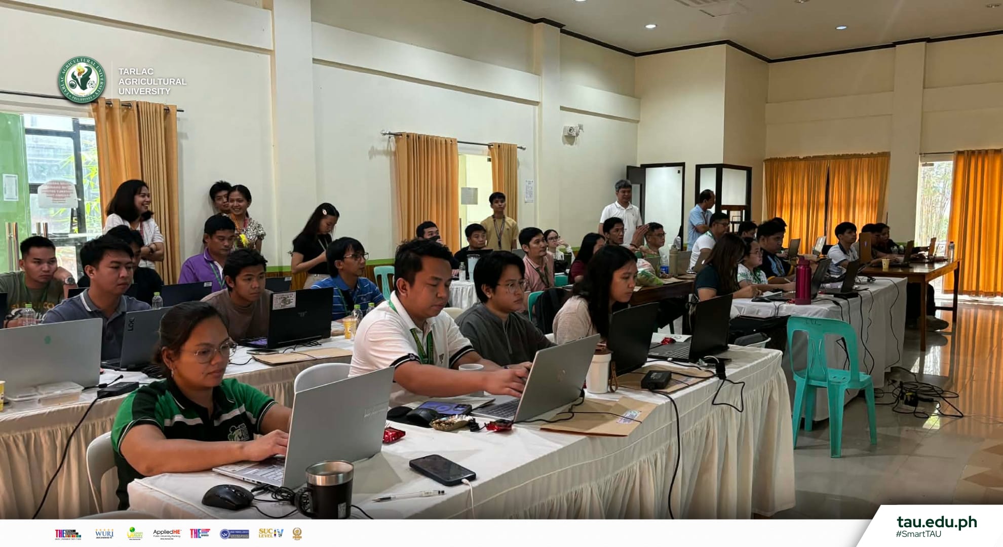
The Tarlac Agricultural University (TAU), through the National Service Training Program (NSTP) and College of Engineering and Technology (CET), kicks off a training workshop on Geographic Information Systems (GIS) for University and Local Disaster Risk Reduction and Management (LDRRM) Practitioners at the Bamboo Training Center (BTC), 5-6 March.
The training brings together lecturers from CET, participants from various Municipal Disaster Risk Reduction and Management Offices (MDRRMOs), and select TAU officials to strengthen the use of GIS technology in disaster preparedness, response, and risk management for the university and local communities.
The program will continue on the 12th, 13th, and 19th of March, focusing on further exploring the uses of GIS through hands-on workshops, analysis, and discussions.
#SmartTAU #GreenandGlobal #GIS #CET #NSTP #SDG4 #SDG9 #SDG11 #SDG13 #SDG14 #SDG15 #SDG17
Text | Carmina S. Melchor [Information Unit]
Photos | Mark Vincent L. Tripoli and Carmina S. Melchor [Information Unit]
Graphics | Nelmar A. Mallari [Information Unit]